
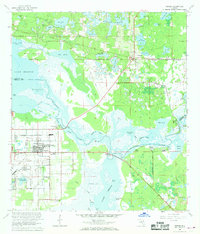
1949 Map of Osceola
USGS Topo · Published 1983About this map
Vero Beach and the neighboring citrus-era settlements of Nevins and Oslo anchor this coastal survey, reflecting the mid-century development of the Florida shoreline. The landscape is defined by the rigid geometry of the drainage system, most notably the South Canal, which cuts through the flat terrain toward the Indian River Aquatic Preserve. Transportation networks are heavily represented by the Florida East Coast railway and the East Coast Highway, which parallel the coast and supported the region's agricultural and burgeoning tourism sectors.
Find a feature on this map
26 named features on this map. Tap any name to fly to it.
Don’t see what you’re looking for? This feature index may not catch every label — zoom into the map to look around manually.
Map Details
Editions of this 1949 Osceola Map
This is the sole edition of this map. No revisions or reprints were ever made.
Other maps of this area

1950 · Maytown
USGS Topo · 1:24,000

1950 · Edgewater
USGS Topo · 1:24,000

1950 · Aurantia
USGS Topo · 1:24,000

1953 · Geneva
USGS Topo · 1:24,000

1955 · Orlando
USGS Topo · 1:250,000

1956 · Oviedo
USGS Topo · 1:24,000

1957 · Orlando
USGS Topo · 1:250,000

1958 · Orlando
USGS Topo · 1:250,000

1962 · Orlando
USGS Topo · 1:250,000
1965 · Osteen
USGS Topo · 1:24,000