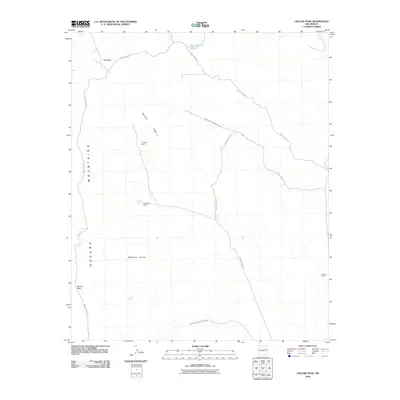
2010 Map of Oscura Peak
USGS Topo · Published 2010About this map
The Oscura Mountains define the western reaches of this desert landscape, anchored by the high points of Oscura Peak and Bug Peak. This territory is dominated by the White Sands Missile Range, where restricted access and government use have largely preserved the sparse footprint of earlier ranching life. Scattered homesteads such as the A D Helm Ranch, H B Helm Ranch, and Withers Ranch appear near essential water sources like Dripping Spring and Hog Sup Spring. Navigating the high-desert terrain, a network of service roads including WSMR S Route 331 and WSMR P Route 9 traces the contours of Workman Ridge and the depths of Whitmore Canyon, providing a rare look at the infrastructure within this high-security military installation.
Find a feature on this map
16 named features on this map. Tap any name to fly to it.
Don’t see what you’re looking for? This feature index may not catch every label — zoom into the map to look around manually.
Map Details
Editions of this 2010 Oscura Peak Map
This is the sole edition of this map. No revisions or reprints were ever made.
Other maps of this area

1918 · Oscura Peak
USGS Topo · 1:125,000

1948 · Broken Back Crater
USGS Topo · 1:62,500

1948 · Bingham
USGS Topo · 1:62,500

1948 · Chihuahua Ranch
USGS Topo · 1:62,500

1948 · Mockingbird Gap
USGS Topo · 1:62,500

1954 · Tularosa
USGS Topo · 1:250,000

1958 · Tularosa
USGS Topo · 1:250,000
1981 · Bull Gap SW
USGS Topo · 1:24,000
1981 · Trinity Site
USGS Topo · 1:24,000
1982 · Red Canyon
USGS Topo · 1:24,000