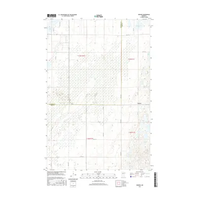
2016 Map of Oshawa
USGS Topo · Published 2016About this map
The settlement of Oshawa serves as a primary reference point in this landscape where the boundaries of Hubbard Co and Cass Co meet. This mid-2010s survey reveals a region defined by its glacial hydrology, with South Haynes Lake and Mow Lake situated among extensive wetlands. The transport network is a mix of established county routes like Co Hwy 19 and descriptive local tracks such as Logs Cross Rd. This pattern of road development reflects the township and range system, with corridors like 72nd Ave NW and 12th St NW tracing the section lines of t139n r32w and t138n r31w. The map provides a precise look at the interface between rural development and the natural water bodies of the Minnesota lake country, including Nagel Lake and Duffy Lake.
Find a feature on this map
27 named features on this map. Tap any name to fly to it.
Don’t see what you’re looking for? This feature index may not catch every label — zoom into the map to look around manually.
Map Details
Editions of this 2016 Oshawa Map
This is the sole edition of this map. No revisions or reprints were ever made.
Other maps of this area
1919 · Leader
USGS Topo · 1:62,500
1953 · Brainerd
USGS Topo · 1:250,000
1957 · Brainerd
USGS Topo · 1:250,000
1958 · Brainerd
USGS Topo · 1:250,000
1965 · Brainerd
USGS Topo · 1:250,000
1969 · Burgen Lake
USGS Topo · 1:24,000
1970 · Spider Lake
USGS Topo · 1:24,000
1970 · Backus
USGS Topo · 1:24,000
1970 · Hackensack
USGS Topo · 1:24,000
1970 · Bungo Creek
USGS Topo · 1:24,000