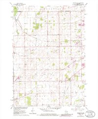
1961 Map of Oshkosh NE
USGS Topo · Published 1986About this map
The Soo Line and Chicago And North Western railroads intersect at Medina Junction in this 1961 survey, documenting the industrial and agricultural landscape northwest of Lake Winnebago. Small rural centers like Larsen and Allenville are central to the township of Clayton, where local infrastructure is marked by the Clayton School, the Townhall, and Immanuel Church.
Find a feature on this map
27 named features on this map. Tap any name to fly to it.
Don’t see what you’re looking for? This feature index may not catch every label — zoom into the map to look around manually.
Map Details
Editions of this 1961 Oshkosh NE Map
3 editions found
Other maps of this area

1911 · Neenah
USGS Topo · 1:62,500

1955 · Neenah
USGS Topo · 1:62,500

1955 · Appleton
USGS Topo · 1:24,000

1955 · Appleton
USGS Topo · 1:62,500

1955 · Neenah
USGS Topo · 1:24,000

1955 · Green Bay
USGS Topo · 1:250,000

1956 · New London
USGS Topo · 1:48,000

1961 · Oshkosh
USGS Topo · 1:24,000

1961 · Oshkosh
USGS Topo · 1:62,500

1961 · Oshkosh NE
USGS Topo · 1:24,000