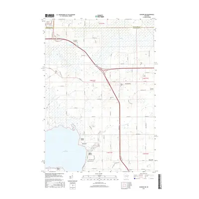
2016 Map of Oshkosh NW
USGS Topo · Published 2016About this map
Lake Winneconne and the meandering Rat River define the low-lying geography of this portion of Winnebago County. The landscape is dotted with small unincorporated settlements and rural church centers, such as Winchester and Larsen, which serve as the primary social hubs for the surrounding agricultural community. Significant local-history value is found in the high density of burial grounds, including the Saint Johannes Evangelical Lutheran Cem and Grace Lutheran Cem, reflecting the early immigrant heritage of the region. The map highlights a transition from the marshy wetlands near Clarks Point to the more developed corridors near Allenville. Modern infrastructure like the Larson Airport sits alongside established rural routes, while the shoreline areas of Piacenza and Indian Shores indicate the lake's importance for local habitation and recreation within this well-watered Wisconsin terrain.
Find a feature on this map
74 named features on this map. Tap any name to fly to it.
Don’t see what you’re looking for? This feature index may not catch every label — zoom into the map to look around manually.
Map Details
Editions of this 2016 Oshkosh NW Map
This is the sole edition of this map. No revisions or reprints were ever made.
Other maps of this area

1955 · Green Bay
USGS Topo · 1:250,000

1956 · New London
USGS Topo · 1:48,000

1956 · Weyauwega
USGS Topo · 1:48,000

1961 · Oshkosh
USGS Topo · 1:24,000

1961 · Poy Sippi
USGS Topo · 1:62,500

1961 · Oshkosh
USGS Topo · 1:62,500

1961 · Lake Poygan
USGS Topo · 1:24,000

1961 · Oshkosh NE
USGS Topo · 1:24,000

1961 · Oshkosh NW
USGS Topo · 1:24,000
1961 · Eureka
USGS Topo · 1:24,000