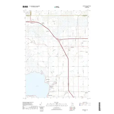
2018 Map of Oshkosh NW
USGS Topo · Published 2018About this map
The Rat River and Arrowhead River wind through the glaciated lowlands of Winnebago and Outagamie counties, leading toward the northern reaches of Lake Winneconne. This landscape is defined by its transition from the expansive wetlands of the river valleys to the organized agricultural plots and small settlements that characterize the region. The village of Winchester serves as a central hub, surrounded by a high density of small family and church burial grounds, including the Saint Johannes Evangelical Lutheran Cem and Winchester Cem. Along the lakefront, shoreline developments such as Indian Shores, Clarks Point, and Piacenza illustrate the recreational and residential draw of the water, while the presence of Larson Airport near Larsen reflects the regional transportation infrastructure in the late twenty-first century.
Find a feature on this map
83 named features on this map. Tap any name to fly to it.
Don’t see what you’re looking for? This feature index may not catch every label — zoom into the map to look around manually.
Map Details
Editions of this 2018 Oshkosh NW Map
This is the sole edition of this map. No revisions or reprints were ever made.
Other maps of this area

1955 · Green Bay
USGS Topo · 1:250,000

1956 · New London
USGS Topo · 1:48,000

1956 · Weyauwega
USGS Topo · 1:48,000

1961 · Oshkosh
USGS Topo · 1:24,000

1961 · Poy Sippi
USGS Topo · 1:62,500

1961 · Oshkosh
USGS Topo · 1:62,500

1961 · Lake Poygan
USGS Topo · 1:24,000

1961 · Oshkosh NE
USGS Topo · 1:24,000

1961 · Oshkosh NW
USGS Topo · 1:24,000
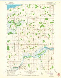
1961 · Eureka
USGS Topo · 1:24,000