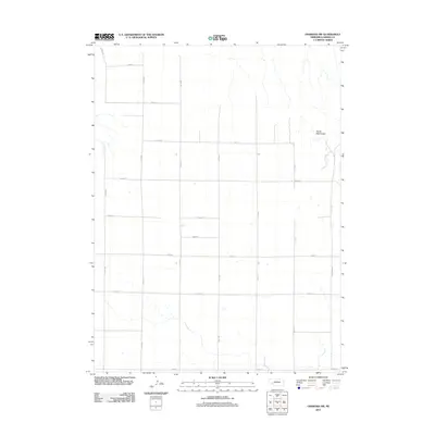
2011 Map of Oshkosh SW
USGS Topo · Published 2011About this map
Devils Washbasin dominates the northeastern corner of this high plains landscape, a distinct topographical feature amidst the expansive grid of the Nebraska panhandle. This 2011 survey by the U.S. Geological Survey documents a region defined by its agricultural layout, where a network of section roads like Road 165 and Road 173 divides the terrain into large, rectangular tracts. The presence of W Canyon Rd suggests the beginning of the more broken, dramatic terrain found as the land dips toward the North Platte River valley just beyond these borders. This map is a record of modern land management and rural infrastructure, providing a detailed baseline of the road system and natural depressions that characterize this portion of Garden County.
Find a feature on this map
18 named features on this map. Tap any name to fly to it.
Don’t see what you’re looking for? This feature index may not catch every label — zoom into the map to look around manually.
Map Details
Editions of this 2011 Oshkosh SW Map
This is the sole edition of this map. No revisions or reprints were ever made.
Other maps of this area

1899 · Sidney
USGS Topo · 1:125,000

1900 · Chappell
USGS Topo · 1:125,000

1954 · Scottsbluff
USGS Topo · 1:250,000

1958 · Scottsbluff
USGS Topo · 1:250,000

1971 · Barn Butte
USGS Topo · 1:24,000

1971 · Chappell NE
USGS Topo · 1:24,000

1971 · Oshkosh SW
USGS Topo · 1:24,000

1971 · Coumbe Bluff
USGS Topo · 1:24,000

1971 · Chappell NW
USGS Topo · 1:24,000
1971 · Oshkosh
USGS Topo · 1:24,000