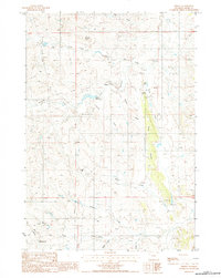
1984 Map of Oshoto
USGS Topo · Published 1985About this map
Oshoto serves as the central hub of this Wyoming landscape, situated where the Missouri Draw meets Little Larson Creek. The map reflects a region defined by livestock ranching and energy extraction, evidenced by the presence of a Uranium Mine and a local Pipeline cutting through the western sections. Water management is critical in this arid terrain, with the Oshoto Reservoir and several named draws like Sidner Draw and Brosa Draw providing the necessary drainage and storage for the area's operations.
Find a feature on this map
23 named features on this map. Tap any name to fly to it.
Don’t see what you’re looking for? This feature index may not catch every label — zoom into the map to look around manually.
Map Details
Editions of this 1984 Oshoto Map
This is the sole edition of this map. No revisions or reprints were ever made.
Other maps of this area

1905 · Devils Tower
USGS Topo · 1:125,000

1918 · Moorcroft
USGS Topo · 1:125,000

1918 · Moorcroft
USGS Topo · 1:62,500

1954 · Carlile
USGS Topo · 1:24,000

1954 · Missouri Buttes
USGS Topo · 1:24,000

1954 · Gillette
USGS Topo · 1:250,000

1955 · Gillette
USGS Topo · 1:250,000

1957 · Moorcroft
USGS Topo · 1:62,500

1957 · Oshoto
USGS Topo · 1:62,500

1958 · Gillette
USGS Topo · 1:250,000