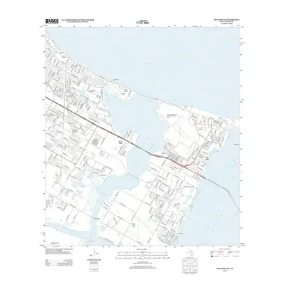
2013 Map of Oso Creek NE
USGS Topo · Published 2013About this map
Corpus Christi Naval Air Station/Truax Field and the surrounding coastal developments define this 2013 landscape along the Texas Gulf Coast. The transition from the urban density of University Heights to the residential expansion of Flour Bluff is clear, mediated by the waters of Oso Bay and the Laguna Madre. Local history and genealogy are well-represented with the inclusion of Seaside Memorial Cem and Aberdeen Cem in the northwest, while the southern reaches show the infrastructure of Waldron Field NOLF and the curious Mud Bridge. Marine activity is concentrated around Laguna Marina and the Oso Fishing Pier, highlighting the area's ongoing relationship with the Corpus Christi Bay shoreline. This detailed survey provides a modern snapshot of the Encinal Peninsula just before continued 21st-century growth further altered the coastal wetlands.
Find a feature on this map
39 named features on this map. Tap any name to fly to it.
Don’t see what you’re looking for? This feature index may not catch every label — zoom into the map to look around manually.
Map Details
Editions of this 2013 Oso Creek NE Map
This is the sole edition of this map. No revisions or reprints were ever made.
Other maps of this area

1925 · Aransas Pass
USGS Topo · 1:62,500

1925 · Oso Creek
USGS Topo · 1:62,500

1925 · Corpus Christi
USGS Topo · 1:62,500

1950 · Corpus Christi
USGS Topo · 1:250,000

1951 · Portland
USGS Topo · 1:24,000

1951 · Corpus Christi
USGS Topo · 1:24,000

1951 · Corpus Christi
USGS Topo · 1:62,500

1951 · Crane Islands NW
USGS Topo · 1:24,000

1951 · Oso Creek NW
USGS Topo · 1:24,000

1951 · Oso Creek NE
USGS Topo · 1:24,000