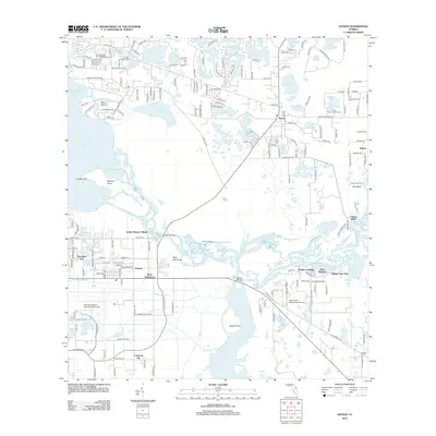
2012 Map of Osteen
USGS Topo · Published 2012About this map
The Saint Johns River and Lake Monroe define this water-dominant landscape near the turn of the 21st century. The map centers on the community of Osteen, where local history is anchored by the Saint Johns Lake Garfield Settlement Cem. To the south, the river forms a complex network of wetlands and seasonal water bodies, including Brickyard Slough, Indian Mound Slough, and Snake Cr.
Find a feature on this map
201 named features on this map. Tap any name to fly to it.
Don’t see what you’re looking for? This feature index may not catch every label — zoom into the map to look around manually.
Map Details
Editions of this 2012 Osteen Map
This is the sole edition of this map. No revisions or reprints were ever made.
Other maps of this area

1949 · Osceola
USGS Topo · 1:24,000

1953 · Geneva
USGS Topo · 1:24,000

1955 · Orlando
USGS Topo · 1:250,000

1956 · Oviedo
USGS Topo · 1:24,000

1957 · Orlando
USGS Topo · 1:250,000

1958 · Orlando
USGS Topo · 1:250,000

1962 · Orlando
USGS Topo · 1:250,000

1962 · Casselberry
USGS Topo · 1:24,000
1964 · Orange City
USGS Topo · 1:24,000
1965 · Osteen
USGS Topo · 1:24,000