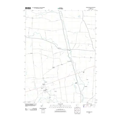
2010 Map of Ostrander
USGS Topo · Published 2010About this map
Ostrander serves as the primary hub of this Delaware County landscape, where the village grid and the Ostrander Post Office anchor a rural region defined by the winding course of the Scioto River. The map highlights a series of small, historic communities that have persisted through generations, including Warrensburg, White Sulphur, and Klondike. For researchers, the presence of numerous burial grounds like Edinburg Cemetery and Minton Cemetery provides essential links to early settlement patterns. Transport and leisure are represented by the Mill Creek Airport and the Millcreek Golf Course, while the Bellefontaine Bridge crosses the river to connect the eastern farmsteads. The terrain is marked by a dense network of watercourses, such as Bokes Creek and Mill Creek, which have historically dictated the placement of roads like Ostrander Rd and Mink Street Rd.
Find a feature on this map
71 named features on this map. Tap any name to fly to it.
Don’t see what you’re looking for? This feature index may not catch every label — zoom into the map to look around manually.
Map Details
Editions of this 2010 Ostrander Map
This is the sole edition of this map. No revisions or reprints were ever made.
Other maps of this area

1901 · Dublin
USGS Topo · 1:62,500

1903 · Dublin
USGS Topo · 1:62,500

1913 · Richwood
USGS Topo · 1:62,500

1915 · Richwood
USGS Topo · 1:62,500

1916 · Milford Center
USGS Topo · 1:62,500

1924 · Delaware
USGS Topo · 1:62,500

1925 · Delaware
USGS Topo · 1:62,500

1944 · Richwood
USGS Topo · 1:62,500

1944 · Milford Center
USGS Topo · 1:62,500

1944 · Delaware
USGS Topo · 1:62,500