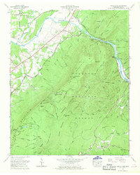
1967 Map of Oswald Dome
USGS Topo · Published 1970About this map
The Hiwassee River cuts through the heart of the Cherokee National Forest in this late 1960s study, revealing a landscape defined by sharp ridges and deep mountain gaps. Small settlements like Reliance and Archville dot the riverbanks and valleys, connected by historic routes such as the Federal Road and the Old Patty Road. The industrial footprint of the era is evident in the Louisville and Nashville railroad tracks following the river's curve, and the presence of a Sileermine near Chilhowee Recreation Area. Genealogists will find numerous family landmarks including the Parris Cem, Dunn Cem, and Reliance Cem, along with community anchors like Antioch Ch and the Mountain View Church. From the heights of Oswald Dome to the bottomlands of Jenkins Island, the map illustrates the persistence of small Tennessee mountain communities within federally managed forest lands.
Find a feature on this map
71 named features on this map. Tap any name to fly to it.
Don’t see what you’re looking for? This feature index may not catch every label — zoom into the map to look around manually.
Map Details
Editions of this 1967 Oswald Dome Map
2 editions found
Other maps of this area

1886 · Cleveland
USGS Topo · 1:125,000

1892 · Cleveland
USGS Topo · 1:125,000

1893 · Murphy
USGS Topo · 1:125,000

1895 · Cleveland
USGS Topo · 1:125,000

1901 · Cleveland
USGS Topo · 1:125,000

1914 · Murphy
USGS Topo · 1:125,000

1934 · Mecca
USGS Topo · 1:24,000

1935 · Tellico
USGS Topo · 1:48,000

1935 · Calhoun
USGS Topo · 1:24,000

1935 · Benton
USGS Topo · 1:24,000