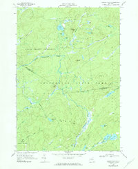
1966 Map of Oswegatchie SE
USGS Topo · Published 1984About this map
The State Forest Preserve and Adirondack State Park dominate this 1966 topographic survey of the border between St. Lawrence and Herkimer Counties. The landscape is defined by its complex hydrology, where the Middle Branch Oswegatchie River and the Alder Bed Branch Oswegatchie River meander through a network of remote water bodies. Clusters of high-altitude ponds, including Streeter Lake, Crystal Lake, and Massawepie Pond, indicate a terrain shaped by glacial activity rather than industrial development. A few human markers, such as a Gravel Pit and a network of Jeep Trails, suggest limited access for forestry or recreational purposes. The map preserves the mid-century character of these wilderness tracts, from the heights of Streeter Mtn down to the secluded basins of Sand Lake and Seitz Lake.
Find a feature on this map
47 named features on this map. Tap any name to fly to it.
Don’t see what you’re looking for? This feature index may not catch every label — zoom into the map to look around manually.
Map Details
Editions of this 1966 Oswegatchie SE Map
2 editions found
Other maps of this area

1903 · Big Moose
USGS Topo · 1:62,500

1912 · Number Four
USGS Topo · 1:62,500

1915 · Number Four
USGS Topo · 1:62,500

1916 · Oswegatchie
USGS Topo · 1:62,500

1918 · Oswegatchie
USGS Topo · 1:62,500

1919 · Cranberry Lake
USGS Topo · 1:62,500

1921 · Cranberry Lake
USGS Topo · 1:62,500

1931 · Cranberry Lake
USGS Topo · 1:62,500

1948 · Ogdensburg
USGS Topo · 1:250,000

1950 · Utica
USGS Topo · 1:250,000