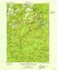
1916 Map of Oswegatchie
USGS Topo · Published 1916About this map
The Oswegatchie River and its multiple branches define the rugged industrial and recreational landscape of this St. Lawrence County region. In the early 20th century, the area was a hub of resource extraction and early hydro-electrification, anchored by Benson Mines and the Browns Fall Power Plant. The settlement of Star Lake appears as a focal point for local life, while smaller hamlets like Jayville, Fine, and Aldrich are connected by a network of logging roads and rail spurs. The map documents a transition from active timbering and mining to the establishment of the Adirondack Park, evidenced by numerous remote outposts such as Streeter Camp, Bassett Camp, and Yousey Camp. Education was highly localized, with several district facilities like White School, Red School, and Manchester School serving the dispersed population of Fine, Clifton, and Pitcairn townships.
Find a feature on this map
119 named features on this map. Tap any name to fly to it.
Don’t see what you’re looking for? This feature index may not catch every label — zoom into the map to look around manually.
Map Details
Editions of this 1916 Oswegatchie Map
3 editions found
Other maps of this area

1903 · Big Moose
USGS Topo · 1:62,500

1911 · Lowville
USGS Topo · 1:62,500

1912 · Number Four
USGS Topo · 1:62,500

1913 · Lowville
USGS Topo · 1:62,500

1913 · Lake Bonaparte
USGS Topo · 1:62,500

1915 · Gouverneur
USGS Topo · 1:62,500

1915 · Number Four
USGS Topo · 1:62,500

1915 · Russell
USGS Topo · 1:62,500

1916 · Lake Bonaparte
USGS Topo · 1:62,500

1916 · Oswegatchie
USGS Topo · 1:62,500