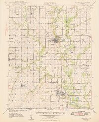
1948 Map of Oswego
USGS Topo · Published 1948About this map
The Neosho River valley in southeast Kansas reveals a landscape shaped by both intensive industrial activity and early agrarian settlement. The massive Kansas Ordnance Plant Area dominates the northern reaches, while the southeastern corner is marked by numerous Strip Mines that signal the region's coal extraction history. The towns of Oswego and Chetopa serve as the primary hubs, linked by the Missouri Kansas Texas and St Louis San Francisco railroads.
Find a feature on this map
82 named features on this map. Tap any name to fly to it.
Don’t see what you’re looking for? This feature index may not catch every label — zoom into the map to look around manually.
Map Details
Editions of this 1948 Oswego Map
3 editions found
Other maps of this area

1886 · Joplin
USGS Topo · 1:125,000

1886 · Parsons
USGS Topo · 1:125,000

1893 · Parsons
USGS Topo · 1:125,000

1894 · Joplin
USGS Topo · 1:125,000

1901 · Vinita
USGS Topo · 1:125,000

1907 · Wyandotte
USGS Topo · 1:125,000

1909 · Wyandotte
USGS Topo · 1:125,000

1913 · Vinita
USGS Topo · 1:125,000

1918 · Columbus
USGS Topo · 1:62,500

1943 · McCune
USGS Topo · 1:62,500