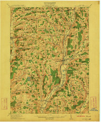
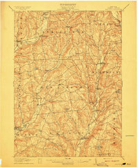
1943 Map of Otego
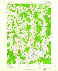
USGS Topo · Published 1960About this map
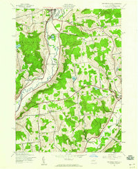
The Susquehanna River valley defines the character of this southern Otsego County landscape during the early 1940s. The village of Otego serves as the primary hub, situated where the Delaware and Hudson railroad tracks parallel the river's winding course. This era shows a distributed rural society organized around small crossroads like Cook Corners and Otsdawa, where local education and faith were anchored by sites such as School No 4 and the Otego Ch. The terrain is deeply incised by a network of waterways including Otsdawa Creek, Flax Island Creek, and Wheaton Creek, which separate the prominent heights of Baker Hill and Chamberlain Hill. For those tracing family histories, numerous small burial grounds are meticulously noted throughout the hills, from Burdick Cem in the north to Bundy Cem and Evergreen Cem near the valley floor.
Find a feature on this map
36 named features on this map. Tap any name to fly to it.
Don’t see what you’re looking for? This feature index may not catch every label — zoom into the map to look around manually.
Map Details
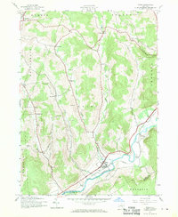
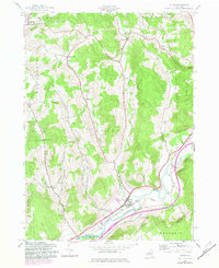
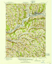
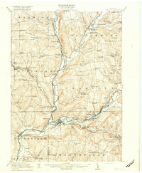
Editions of this 1943 Otego Map
3 editions found
Other maps of this area

1910 · Hartwick
USGS Topo · 1:62,500

1910 · New Berlin
USGS Topo · 1:62,500
1912 · New Berlin
USGS Topo · 1:62,500
1912 · Hartwick
USGS Topo · 1:62,500
1915 · Oneonta
USGS Topo · 1:62,500

1915 · Unadilla
USGS Topo · 1:62,500
1918 · Unadilla
USGS Topo · 1:62,500

1918 · Oneonta
USGS Topo · 1:62,500
1943 · Mt Vision
USGS Topo · 1:24,000
1943 · New Berlin South
USGS Topo · 1:24,000