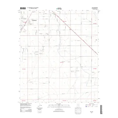
2013 Map of Otis
USGS Topo · Published 2013About this map
Carlsbad and the neighboring settlement of Otis define the northern portion of this landscape, where the agricultural legacy of the Pecos Valley is clearly marked by extensive irrigation infrastructure. The Carlsbad-Irr Dist Right Of Way and the Southern Canal illustrate the engineering required to sustain local ranching and farming operations, such as Forehand Ranch, in this arid environment. The Pecos River serves as the primary hydrological spine of the region, feeding into Municipal Lake near the city center. A dense network of local roads, including Oil Field Rd and Pecos Hwy, connects various township sections and industrial sites, reflecting the area's development through both cattle ranching and natural resource extraction. Natural drainage features like Cass Draw cut across the southern reaches, highlighting the native topography that dictates the placement of modern settlements and transport corridors.
Find a feature on this map
105 named features on this map. Tap any name to fly to it.
Don’t see what you’re looking for? This feature index may not catch every label — zoom into the map to look around manually.
Map Details
Editions of this 2013 Otis Map
This is the sole edition of this map. No revisions or reprints were ever made.
Other maps of this area

1939 · Carlsbad
USGS Topo · 1:62,500

1943 · Carlsbad
USGS Topo · 1:62,500

1943 · West Carlsbad
USGS Topo · 1:62,500

1945 · West Carlsbad
USGS Topo · 1:62,500

1945 · Carlsbad Caverns East
USGS Topo · 1:62,500

1945 · Malaga
USGS Topo · 1:62,500

1946 · Malaga
USGS Topo · 1:62,500

1947 · Carlsbad Caverns East
USGS Topo · 1:62,500

1954 · Carlsbad
USGS Topo · 1:250,000

1958 · Carlsbad
USGS Topo · 1:250,000