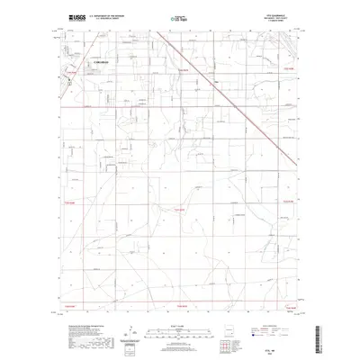
2020 Map of Otis
USGS Topo · Published 2020About this map
The southeastern outskirts of Carlsbad and the neighboring settlement of Otis anchor this high-desert landscape in Eddy County. The map details a complex network of rural and residential roads, including the historic Old Cavern Hwy and major thoroughfares like Us 285. The agricultural character of the region is evident through the vital water infrastructure provided by the Southern Canal and the course of the Pecos River in the northeastern corner. This 2020 survey illustrates how modern development interfaces with traditional land use, marked by features such as Walker Farm Rd and Airport Ave. The terrain is characterized by subtle drainage patterns like Cass Draw and a grid-based property system defined by various township and range lines. Local history and genealogy researchers can find specific interest in named family roads and established community boundaries that define the corridor south of the city.
Find a feature on this map
137 named features on this map. Tap any name to fly to it.
Don’t see what you’re looking for? This feature index may not catch every label — zoom into the map to look around manually.
Map Details
Editions of this 2020 Otis Map
This is the sole edition of this map. No revisions or reprints were ever made.
Other maps of this area

1939 · Carlsbad
USGS Topo · 1:62,500

1943 · Carlsbad
USGS Topo · 1:62,500

1943 · West Carlsbad
USGS Topo · 1:62,500

1945 · West Carlsbad
USGS Topo · 1:62,500

1945 · Carlsbad Caverns East
USGS Topo · 1:62,500

1945 · Malaga
USGS Topo · 1:62,500

1946 · Malaga
USGS Topo · 1:62,500

1947 · Carlsbad Caverns East
USGS Topo · 1:62,500

1954 · Carlsbad
USGS Topo · 1:250,000

1958 · Carlsbad
USGS Topo · 1:250,000