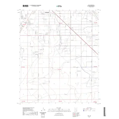
2023 Map of Otis
USGS Topo · Published 2023About this map
The settlement of Otis serves as the focal point of this Eddy County landscape, where the agricultural and industrial infrastructure of southeast New Mexico is clearly defined. The terrain is marked by the presence of the Pecos River in the northeast corner and the winding path of the Southern Canal, which supports the local irrigation network. To the north, the outskirts of Carlsbad appear with a dense grid of streets such as Energy Ave and Carlgo St, reflecting the area's development. Rural life is anchored by family and local identifiers, including the Cuba Cem and the Walker Farm Rd. The map detail reveals a transition from these clustered homesteads to more open areas like Cass Draw, illustrating how water management via the canal system has shaped the desert environment for modern use.
Find a feature on this map
104 named features on this map. Tap any name to fly to it.
Don’t see what you’re looking for? This feature index may not catch every label — zoom into the map to look around manually.
Map Details
Editions of this 2023 Otis Map
This is the sole edition of this map. No revisions or reprints were ever made.
Other maps of this area

1939 · Carlsbad
USGS Topo · 1:62,500

1943 · Carlsbad
USGS Topo · 1:62,500

1943 · West Carlsbad
USGS Topo · 1:62,500

1945 · West Carlsbad
USGS Topo · 1:62,500

1945 · Carlsbad Caverns East
USGS Topo · 1:62,500

1945 · Malaga
USGS Topo · 1:62,500

1946 · Malaga
USGS Topo · 1:62,500

1947 · Carlsbad Caverns East
USGS Topo · 1:62,500

1954 · Carlsbad
USGS Topo · 1:250,000

1958 · Carlsbad
USGS Topo · 1:250,000