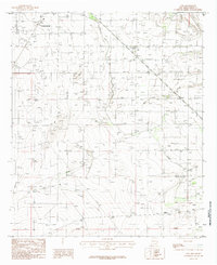
1985 Map of Otis
USGS Topo · Published 1985About this map
Agricultural infrastructure and water management define this mid-1980s landscape southeast of Carlsbad. The settlement of Otis sits as a primary waypoint amidst a network of irrigation and flood control, dominated by the Southern Canal and the winding course of the Pecos River. The terrain is marked by a series of engineered features including a long Levee and numerous drainage structures along Cass Draw, illustrating the efforts to reclaim and protect the arid Basin and Range lands for local utility. Industrial and residential footprints are visible in the form of multiple Gravel Pits and a designated Trailer Park near the city periphery. Farther into the open country, scattered landmarks such as a Radio Facility, a Pumping Station, and livestock infrastructure like the Corral and Wm Corral reflect a rural economy tied to ranching and resource extraction.
Find a feature on this map
15 named features on this map. Tap any name to fly to it.
Don’t see what you’re looking for? This feature index may not catch every label — zoom into the map to look around manually.
Map Details
Editions of this 1985 Otis Map
This is the sole edition of this map. No revisions or reprints were ever made.
Other maps of this area

1939 · Carlsbad
USGS Topo · 1:62,500

1943 · Carlsbad
USGS Topo · 1:62,500

1943 · West Carlsbad
USGS Topo · 1:62,500

1945 · West Carlsbad
USGS Topo · 1:62,500

1945 · Carlsbad Caverns East
USGS Topo · 1:62,500

1945 · Malaga
USGS Topo · 1:62,500

1946 · Malaga
USGS Topo · 1:62,500

1947 · Carlsbad Caverns East
USGS Topo · 1:62,500

1954 · Carlsbad
USGS Topo · 1:250,000

1958 · Carlsbad
USGS Topo · 1:250,000