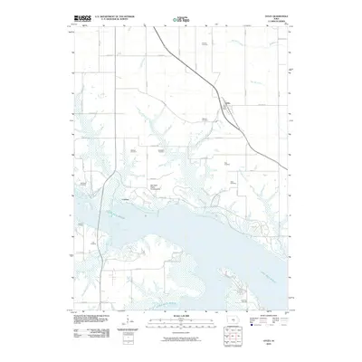
2010 Map of Otley
USGS Topo · Published 2010About this map
Lake Red Rock dominates the southern landscape of this Marion County survey, its expansive waters meeting the shoreline at Cordova and the Red Rock Public Hunting Area. This region reveals a dense concentration of early family and community burial grounds, preserving the genealogy of the area through sites such as Pendrcy Cemetery, Mikesell Cemetery, and Burkhalter Cemetery. These landmarks are scattered across a terrain drained by numerous watercourses, including Wildcat Creek, Thunder Creek, and Van Zante Creek.
Find a feature on this map
35 named features on this map. Tap any name to fly to it.
Don’t see what you’re looking for? This feature index may not catch every label — zoom into the map to look around manually.
Map Details
Editions of this 2010 Otley Map
This is the sole edition of this map. No revisions or reprints were ever made.
Other maps of this area

1909 · Knoxville
USGS Topo · 1:62,500

1910 · Pella
USGS Topo · 1:62,500

1912 · Knoxville
USGS Topo · 1:62,500

1912 · Pella
USGS Topo · 1:62,500

1954 · Des Moines
USGS Topo · 1:250,000

1956 · Des Moines
USGS Topo · 1:250,000

1957 · Des Moines
USGS Topo · 1:250,000

1965 · Prairie City
USGS Topo · 1:24,000

1965 · Knoxville NW
USGS Topo · 1:24,000

1965 · Monroe
USGS Topo · 1:24,000