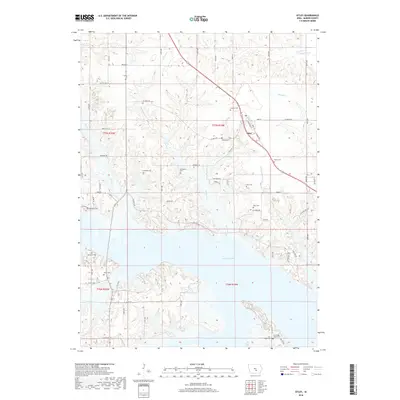
2018 Map of Otley
USGS Topo · Published 2018About this map
The community of Otley and the sprawling waters of Lake Red Rock dominate this 2018 study of Summit Township in Marion County. The landscape is heavily marked by its pioneer and rural heritage, evidenced by a high density of family and community burial grounds including Mikesell Cem, Burkhalter Cem, and Fisher Cem. The southern half of the map is defined by the Des Moines River valley, where the reservoir has altered the original topography of Wildcat Creek and Teter Cr. Near the shoreline, Coal Ridge Church and the adjacent Coal Ridge Cem stand as significant landmarks for local history. To the north, the terrain transitions into a complex system of drainage including Van Zante Cr and Thunder Cr, showing the persistent agricultural character of the land outside the immediate influence of the reservoir.
Find a feature on this map
45 named features on this map. Tap any name to fly to it.
Don’t see what you’re looking for? This feature index may not catch every label — zoom into the map to look around manually.
Map Details
Editions of this 2018 Otley Map
This is the sole edition of this map. No revisions or reprints were ever made.
Other maps of this area

1909 · Knoxville
USGS Topo · 1:62,500

1910 · Pella
USGS Topo · 1:62,500

1912 · Knoxville
USGS Topo · 1:62,500

1912 · Pella
USGS Topo · 1:62,500

1954 · Des Moines
USGS Topo · 1:250,000

1956 · Des Moines
USGS Topo · 1:250,000

1957 · Des Moines
USGS Topo · 1:250,000

1965 · Prairie City
USGS Topo · 1:24,000

1965 · Knoxville NW
USGS Topo · 1:24,000

1965 · Monroe
USGS Topo · 1:24,000