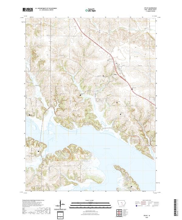
2022 Map of Otley
USGS Topo · Published 2022About this map
Otley is the central hub of this agricultural and riparian landscape, situated north of the expansive Lake Red Rock. The area is notably dense with historical burial sites, including Pendroy Cem, Gibbons Cem, and the Coal Ridge Church Cem, offering significant data for genealogical research in Marion County. The terrain is defined by a network of waterways like Van Zante Cr, Wildcat Creek, and Brush Creek that drain toward the reservoir. The map reveals a transition from the structured grid of rural roads like Co HWY g18 and Co HWY g28 to the irregular, indented shoreline of the lake. This shoreline is characterized by several trail systems including the North Loop Tr and East Loop Tr, reflecting the modern land use of the region as a balance between established farming communities and recreational conservation areas.
Find a feature on this map
74 named features on this map. Tap any name to fly to it.
Don’t see what you’re looking for? This feature index may not catch every label — zoom into the map to look around manually.
Map Details
Editions of this 2022 Otley Map
This is the sole edition of this map. No revisions or reprints were ever made.
Other maps of this area

1909 · Knoxville
USGS Topo · 1:62,500

1910 · Pella
USGS Topo · 1:62,500

1912 · Knoxville
USGS Topo · 1:62,500

1912 · Pella
USGS Topo · 1:62,500

1954 · Des Moines
USGS Topo · 1:250,000

1956 · Des Moines
USGS Topo · 1:250,000

1957 · Des Moines
USGS Topo · 1:250,000

1965 · Prairie City
USGS Topo · 1:24,000

1965 · Knoxville NW
USGS Topo · 1:24,000

1965 · Monroe
USGS Topo · 1:24,000