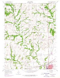
1956 Map of Ottawa North
USGS Topo · Published 1976About this map
Centropolis sits at the heart of this landscape, surrounded by a dense network of rural schools and churches that defined early settlement life in northern Franklin County. The map reveals a community organized around family and faith, with local institutions such as Union Ch, Chapel Hill Sch, and Mt Evergreen Cem serving the surrounding agricultural sections. Of particular historical note is the Old Indian Boundary, which cuts across the townships of Centropolis and Hayes, a physical reminder of earlier territorial divisions.
Find a feature on this map
34 named features on this map. Tap any name to fly to it.
Don’t see what you’re looking for? This feature index may not catch every label — zoom into the map to look around manually.
Map Details
Editions of this 1956 Ottawa North Map
3 editions found
Other maps of this area

1885 · Lawrence
USGS Topo · 1:125,000

1889 · Lawrence
USGS Topo · 1:125,000

1947 · Lawrence
USGS Topo · 1:250,000

1950 · Lawrence
USGS Topo · 1:250,000

1955 · Globe
USGS Topo · 1:24,000

1956 · Pomona
USGS Topo · 1:24,000

1956 · Ottawa North
USGS Topo · 1:24,000

1956 · Le Loup
USGS Topo · 1:24,000

1956 · Ottawa South
USGS Topo · 1:24,000

1956 · Lawrence
USGS Topo · 1:250,000