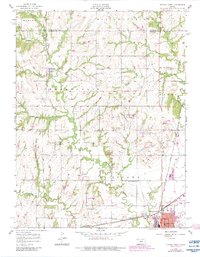
1956 Map of Ottawa North
USGS Topo · Published 1983About this map
Centropolis and the northern outskirts of Ottawa anchor this mid-century landscape where rural educational and spiritual centers define the community structure. The map records a dense network of country schools, including Minneola Sch, Chapel Hill Sch, and Sand Creek Sch, alongside the Union Ch and Mt Evergreen Cem, providing critical data points for genealogists and local historians. The regional transportation backbone is clearly delineated by the Atchison Topeka and Santa Fe and Missouri Pacific railroads, which converge near Ottawa Junction. Of particular interest is the Old Indian Boundary crossing the center of the sheet, reflecting the area's complex jurisdictional history. Water features such as Eightmile Creek and the Fish Hatchery at Natural Springs Lake highlight the intersection of natural drainage and early conservation efforts.
Find a feature on this map
39 named features on this map. Tap any name to fly to it.
Don’t see what you’re looking for? This feature index may not catch every label — zoom into the map to look around manually.
Map Details
Editions of this 1956 Ottawa North Map
3 editions found
Other maps of this area

1885 · Lawrence
USGS Topo · 1:125,000

1889 · Lawrence
USGS Topo · 1:125,000

1947 · Lawrence
USGS Topo · 1:250,000

1950 · Lawrence
USGS Topo · 1:250,000

1955 · Globe
USGS Topo · 1:24,000

1956 · Pomona
USGS Topo · 1:24,000

1956 · Ottawa North
USGS Topo · 1:24,000

1956 · Le Loup
USGS Topo · 1:24,000

1956 · Ottawa South
USGS Topo · 1:24,000

1956 · Lawrence
USGS Topo · 1:250,000