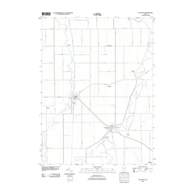
2010 Map of Ottoville
USGS Topo · Published 2010About this map
The Auglaize River and Little Auglaize River define the agricultural landscape of this Putnam County region, where the historic settlements of Ottoville and Fort Jennings serve as primary anchors. The map reveals a high density of rural burial grounds, such as Antioch Cemetery, Holden Cemetery, and Hammons Cemetery, providing essential data for genealogists tracking early pioneer families. In Ottoville, the Ottoville Post Office and Saint Marys Cemetery are prominent landmarks, while further south, Fort Jennings is situated near the confluence of local waterways and the Fort Jennings Post Office. Smaller locales like Muntanna, Douglas, and Rushmore punctuate the grid-like road network. Notable infrastructure includes the Gerker Airfield and numerous drainage features like Big Run, Jennings Creek, and Flat Fork, illustrating the area's intensive land management and waterway-reliant development.
Find a feature on this map
60 named features on this map. Tap any name to fly to it.
Don’t see what you’re looking for? This feature index may not catch every label — zoom into the map to look around manually.
Map Details
Editions of this 2010 Ottoville Map
This is the sole edition of this map. No revisions or reprints were ever made.
Other maps of this area

1906 · Columbus Grove
USGS Topo · 1:62,500

1908 · Columbus Grove
USGS Topo · 1:62,500

1908 · Ottawa
USGS Topo · 1:62,500

1909 · Continental
USGS Topo · 1:62,500

1911 · Delphos
USGS Topo · 1:62,500

1944 · Delphos
USGS Topo · 1:62,500

1953 · Fort Wayne
USGS Topo · 1:250,000

1953 · Muncie
USGS Topo · 1:250,000

1956 · Muncie
USGS Topo · 1:250,000

1956 · Fort Wayne
USGS Topo · 1:250,000