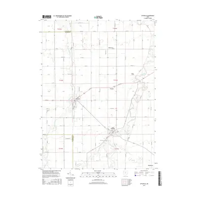
2016 Map of Ottoville
USGS Topo · Published 2016About this map
The Little Auglaize River and the larger Auglaize River define the agricultural landscape of western Putnam County, meandering through a grid of rural roads and small townships. In Ottoville, the street plan centers on the intersection of Us Rte 224 and Main St, where local landmarks like Saint Marys Cem are located. Further south, the village of Fort Jennings sits at a strategic bend in the river, marked by Saint Josephs Cem and the nearby Mount Calvary Cem. The area’s historical footprint is well-preserved through numerous small family and parish burial grounds, including Antioch Cem and Raabe Cem. This region maintains a strongly rural character, with the Gerker Airfield and small clusters like Muntanna and Douglas punctuating the vast stretches of farmland between the river forks.
Find a feature on this map
29 named features on this map. Tap any name to fly to it.
Don’t see what you’re looking for? This feature index may not catch every label — zoom into the map to look around manually.
Map Details
Editions of this 2016 Ottoville Map
This is the sole edition of this map. No revisions or reprints were ever made.
Other maps of this area

1906 · Columbus Grove
USGS Topo · 1:62,500

1908 · Columbus Grove
USGS Topo · 1:62,500

1908 · Ottawa
USGS Topo · 1:62,500

1909 · Continental
USGS Topo · 1:62,500

1911 · Delphos
USGS Topo · 1:62,500

1944 · Delphos
USGS Topo · 1:62,500

1953 · Fort Wayne
USGS Topo · 1:250,000

1953 · Muncie
USGS Topo · 1:250,000

1956 · Muncie
USGS Topo · 1:250,000

1956 · Fort Wayne
USGS Topo · 1:250,000