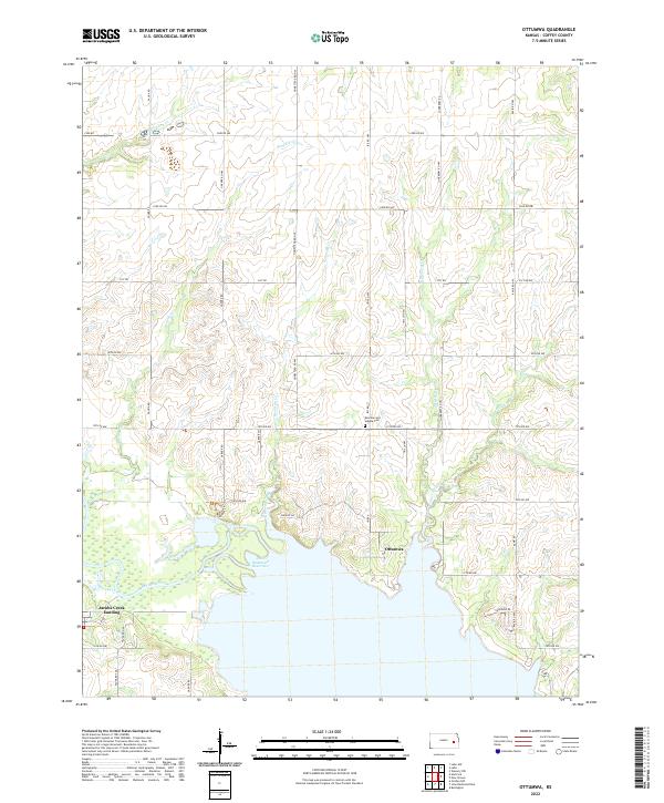
2022 Map of Ottumwa
USGS Topo · Published 2022About this map
John Redmond Reservoir dominates the southern landscape of this Coffey County region, where the Neosho River valley was transformed by mid-century water management projects. The small settlement of Ottumwa sits near the reservoir's northeastern shore, serving as a focal point for a landscape defined by a dense network of creek drainages including Benedict Cr, Kennedy Cr, and East Hickory Creek. The presence of the Bowman and Adgate Cem north of the town site provides a localized point of interest for genealogists tracing early families in the township. To the west, Jacobs Creek Landing offers access to the water where Jacobs Creek meets the main reservoir body. The area remains primarily rural, characterized by a systematic grid of county roads such as Iris Rd and Fauna Rd that navigate the gently dissected plains above the river valley.
Find a feature on this map
44 named features on this map. Tap any name to fly to it.
Don’t see what you’re looking for? This feature index may not catch every label — zoom into the map to look around manually.
Map Details
Editions of this 2022 Ottumwa Map
This is the sole edition of this map. No revisions or reprints were ever made.
Other maps of this area

1885 · Burlington
USGS Topo · 1:125,000

1894 · Burlington
USGS Topo · 1:125,000

1947 · Lawrence
USGS Topo · 1:250,000

1950 · Lawrence
USGS Topo · 1:250,000

1956 · Lawrence
USGS Topo · 1:250,000

1957 · Lebo
USGS Topo · 1:24,000

1957 · Waverly NW
USGS Topo · 1:24,000
1957 · Lebo NW
USGS Topo · 1:24,000

1961 · Lawrence
USGS Topo · 1:250,000
1966 · John Redmond Dam
USGS Topo · 1:24,000