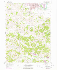
1956 Map of Ottumwa South
USGS Topo · Published 1978About this map
The Des Moines River cuts through the northeast corner of this landscape, marking the transition from the urban expansion of Ottumwa to the rural townships of southern Wapello and Davis Counties. The terrain south of the city is defined by a dense network of drainage, where Kettle Creek, Village Creek, and Sandy Creek carve through the glacial till. Transportation is anchored by the Wabash line, which parallels the river and connects the larger industrial center to outlying settlements like Carbon and Ormanville.
Find a feature on this map
43 named features on this map. Tap any name to fly to it.
Don’t see what you’re looking for? This feature index may not catch every label — zoom into the map to look around manually.
Map Details
Editions of this 1956 Ottumwa South Map
2 editions found
Other maps of this area

1954 · Centerville
USGS Topo · 1:250,000

1954 · Des Moines
USGS Topo · 1:250,000

1956 · Des Moines
USGS Topo · 1:250,000

1956 · Farson
USGS Topo · 1:24,000

1956 · Agency
USGS Topo · 1:24,000

1956 · Ottumwa North
USGS Topo · 1:62,500

1956 · Ottumwa South
USGS Topo · 1:24,000

1956 · Ottumwa South
USGS Topo · 1:62,500

1956 · Ottumwa North
USGS Topo · 1:24,000

1957 · Des Moines
USGS Topo · 1:250,000