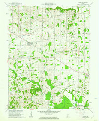
1961 Map of Otwell
USGS Topo · Published 1962About this map
The Otwell Holiness Camp stands at the center of this rural landscape where the boundaries of Jefferson, Boone, Marion, and Madison townships meet. This early 1960s survey documents a region defined by its small crossroads settlements like Otwell, Iva, and Ireland, each supporting a network of country churches and family cemeteries. The terrain shifts from the agricultural fields along Strawberry Road to the southern reaches of the Pike County State Forest. Natural drainage patterns are clearly visible through the winding paths of Birch Creek and Flat Creek, which eventually reach the Big Bottom lowlands and the Patoka River. Genealogists will find significant value in the mapped locations of institutional sites like the County Home and numerous local landmarks such as New Lebanon Ch and the Armstrong Cem.
Find a feature on this map
49 named features on this map. Tap any name to fly to it.
Don’t see what you’re looking for? This feature index may not catch every label — zoom into the map to look around manually.
Map Details
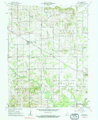
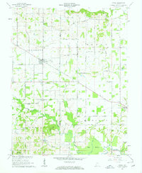
Editions of this 1961 Otwell Map
3 editions found
Other maps of this area

1902 · Ditney
USGS Topo · 1:125,000

1903 · Velpen
USGS Topo · 1:62,500

1944 · Glendale
USGS Topo · 1:24,000

1945 · Sandy Hook
USGS Topo · 1:24,000

1946 · Jasper
USGS Topo · 1:24,000

1954 · Huntingburg
USGS Topo · 1:24,000

1956 · Alfordsville
USGS Topo · 1:24,000

1956 · Vincennes
USGS Topo · 1:250,000

1957 · Vincennes
USGS Topo · 1:250,000

1958 · Vincennes
USGS Topo · 1:250,000