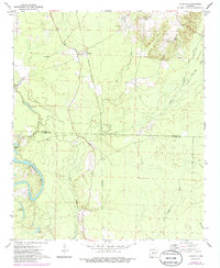
1971 Map of Ouachita
USGS Topo · Published 1986About this map
Ouachita and Smead center this riverine landscape during the early 1970s, situated along the border of Dallas and Ouachita counties. The wide, meandering Ouachita River dominates the southwestern terrain, flanked by several cutoff bodies including Georgia Lake, Utley Lake, and Bacon Lake. The mapping reveals a rural economy shaped by timber and water, with numerous creeks like Tulip Creek and Hall Creek carving through the lowlands. Local genealogy interests are well-served by the presence of Brazeale Cem, Chapel Hill Ch, and Smead Ch. An interesting industrial transition is captured by a railroad line marked Abandoned, which once connected these small settlements to the broader regional markets before the tracks were lifted.
Find a feature on this map
19 named features on this map. Tap any name to fly to it.
Don’t see what you’re looking for? This feature index may not catch every label — zoom into the map to look around manually.
Map Details
Editions of this 1971 Ouachita Map
2 editions found
Other maps of this area

1903 · Camden
USGS Topo · 1:125,000

1953 · El Dorado
USGS Topo · 1:250,000

1957 · El Dorado
USGS Topo · 1:250,000

1958 · El Dorado
USGS Topo · 1:250,000

1960 · El Dorado
USGS Topo · 1:250,000

1971 · Tates Bluff
USGS Topo · 1:24,000
1971 · Sparkman
USGS Topo · 1:24,000

1971 · Ouachita
USGS Topo · 1:24,000
1971 · Harmony Grove
USGS Topo · 1:24,000
1971 · Sparkman NW
USGS Topo · 1:24,000