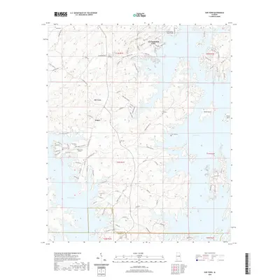
2020 Map of Our Town
USGS Topo · Published 2020About this map
Martin Lake dominates this portion of Tallapoosa and Elmore counties, its winding shoreline shaping the development of the region. The community of Our Town sits at a central inland crossroads, while Bulgers is situated further south near the lake's edge. To the east, Woods Island and Youngs Island are prominent features within the reservoir's waters. The landscape is dotted with historical markers of interest to genealogists, including Mount Zion Cem, Friendship Cem, Mask Cem, and New Hope Cem.
Find a feature on this map
101 named features on this map. Tap any name to fly to it.
Don’t see what you’re looking for? This feature index may not catch every label — zoom into the map to look around manually.
Map Details
Editions of this 2020 Our Town Map
This is the sole edition of this map. No revisions or reprints were ever made.
Other maps of this area

1901 · Wetumpka
USGS Topo · 1:125,000

1901 · Wetumpka
USGS Topo · 1:62,500

1903 · Wetumpka
USGS Topo · 1:125,000

1906 · Dadeville
USGS Topo · 1:125,000

1953 · Montgomery
USGS Topo · 1:250,000

1955 · Phenix City
USGS Topo · 1:250,000

1956 · Montgomery
USGS Topo · 1:250,000

1957 · Phenix City
USGS Topo · 1:250,000

1957 · Montgomery
USGS Topo · 1:250,000

1958 · Phenix City
USGS Topo · 1:250,000