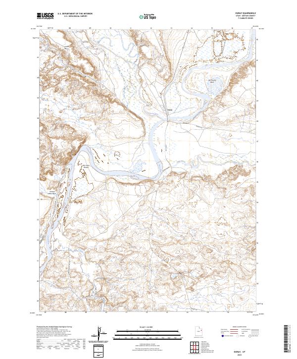
2023 Map of Ouray
USGS Topo · Published 2023About this map
Ouray sits at the vital confluence of the Duchesne River and the Green River, marking a point where water has shaped the landscape and human activity for generations. This modern survey illustrates the complex river system of the Uinta Valley, where the White River also joins the Green nearby. Much of the northern terrain is dedicated to the Ouray National Wildlife Refuge, protecting wetland habitats such as Old Charley Wash.
Find a feature on this map
18 named features on this map. Tap any name to fly to it.
Don’t see what you’re looking for? This feature index may not catch every label — zoom into the map to look around manually.
Map Details
Editions of this 2023 Ouray Map
This is the sole edition of this map. No revisions or reprints were ever made.
Other maps of this area

1885 · East Tavaputs
USGS Topo · 1:250,000

1885 · Ashley
USGS Topo · 1:250,000

1917 · Vernal
USGS Topo · 1:125,000

1953 · Nutters Hole
USGS Topo · 1:62,500

1954 · Vernal
USGS Topo · 1:250,000

1956 · Grand Junction
USGS Topo · 1:250,000

1958 · Vernal
USGS Topo · 1:250,000

1959 · Grand Junction
USGS Topo · 1:250,000

1960 · Vernal
USGS Topo · 1:250,000

1960 · Grand Junction
USGS Topo · 1:250,000