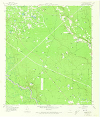
1959 Map of Outlaw Pond
USGS Topo · Published 1973About this map
The Conroe Oil Field dominates the northwestern landscape of this Montgomery County survey, characterized by a dense network of Oil Wells, Sludge Pits, and pipelines. This industrial footprint contrasts with the surrounding wetlands and timberlands, where dozens of named ponds and lakes indicate a high water table and a landscape defined by drainage. Local community life is centered around several country churches and burial grounds, including the Independent Ch, Fire Tower Ch, and Freeman Cem. Transportation and infrastructure are represented by an Old Railroad Grade and an extensive system of man-made waterways like Copeland Ditch, which redirect the flow of the Maple Slough and other local branches. The naming conventions of features like Humble Club Lake and Outlaw Pond reflect the era's social and natural history in this corner of East Texas.
Find a feature on this map
78 named features on this map. Tap any name to fly to it.
Don’t see what you’re looking for? This feature index may not catch every label — zoom into the map to look around manually.
Map Details
Editions of this 1959 Outlaw Pond Map
Other maps of this area

1916 · Moonshine Hill
USGS Topo · 1:24,000

1916 · Spring
USGS Topo · 1:24,000

1919 · Weeden
USGS Topo · 1:31,680

1920 · Spring
USGS Topo · 1:31,680

1920 · Moonshine Hill
USGS Topo · 1:31,680

1954 · Beaumont
USGS Topo · 1:250,000

1957 · Beaumont
USGS Topo · 1:250,000

1958 · Conroe
USGS Topo · 1:24,000

1958 · Fostoria
USGS Topo · 1:24,000

1959 · Outlaw Pond
USGS Topo · 1:24,000