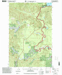
1996 Map of Outlet Bay
USGS Topo · Published 1999About this map
Outlet Bay serves as the gateway between the expansive waters of Priest Lake and the serpentine descent of the Priest River. Located in the southern reach of the Kaniksu National Forest, this landscape is defined by the critical water control infrastructure at the Outlet Dam and the adjacent Gaging Station. The terrain shifts from the high elevations of Outlet Mountain and Gleason Meadow to the river-level floodplains of Jack Pine Flats.
Find a feature on this map
27 named features on this map. Tap any name to fly to it.
Don’t see what you’re looking for? This feature index may not catch every label — zoom into the map to look around manually.
Map Details
Editions of this 1996 Outlet Bay Map
This is the sole edition of this map. No revisions or reprints were ever made.
Other maps of this area

1901 · Sandpoint
USGS Topo · 1:125,000

1911 · Priest Lake
USGS Topo · 1:250,000

1911 · Sandpoint
USGS Topo · 1:125,000

1913 · Priest Lake
USGS Topo · 1:250,000

1934 · Metaline
USGS Topo · 1:125,000

1936 · Newport
USGS Topo · 1:96,000

1942 · Metaline
USGS Topo · 1:125,000

1942 · Newport
USGS Topo · 1:125,000

1958 · Sandpoint
USGS Topo · 1:250,000

1963 · Sandpoint
USGS Topo · 1:250,000