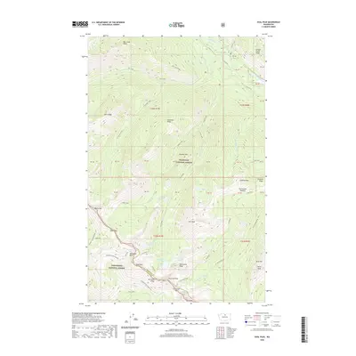
2020 Map of Oval Peak
USGS Topo · Published 2020About this map
Oval Peak rises as the dominant landmark at the intersection of the Okanogan National Forest and Wenatchee National Forest. This high-altitude drainage divide is defined by the Okanogan Co Chelan Co boundary, which follows the jagged crest of Sawtooth Ridge. The geography here is shaped by alpine water systems, featuring a chain of high-elevation basins containing West Oval Lake, Middle Oval Lake, and East Oval Lake.
Find a feature on this map
47 named features on this map. Tap any name to fly to it.
Don’t see what you’re looking for? This feature index may not catch every label — zoom into the map to look around manually.
Map Details
Editions of this 2020 Oval Peak Map
This is the sole edition of this map. No revisions or reprints were ever made.
Other maps of this area
1899 · Methow
USGS Topo · 1:125,000
1901 · Methow
USGS Topo · 1:125,000
1902 · Stehekin
USGS Topo · 1:125,000
1904 · Stehekin
USGS Topo · 1:125,000
1944 · Lucerne
USGS Topo · 1:62,500
1949 · Lucerne
USGS Topo · 1:62,500

1955 · Concrete
USGS Topo · 1:250,000

1958 · Concrete
USGS Topo · 1:250,000

1962 · Concrete
USGS Topo · 1:250,000
1969 · Midnight Mtn.
USGS Topo · 1:24,000