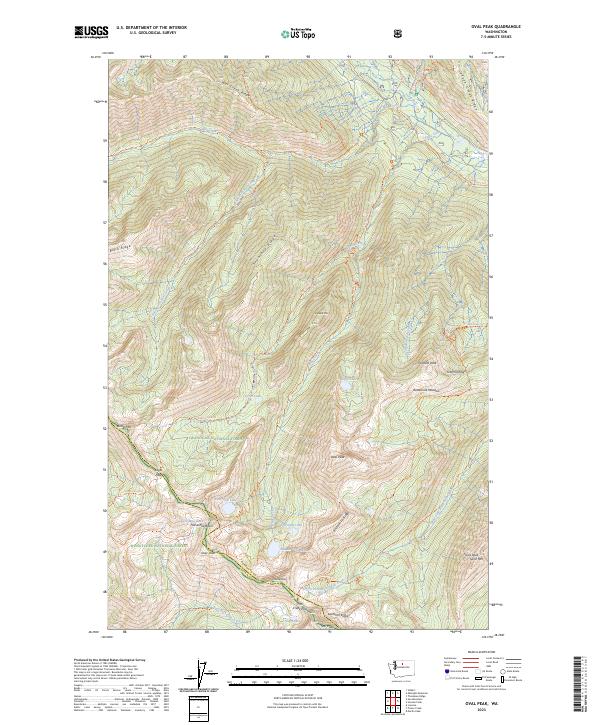
2023 Map of Oval Peak
USGS Topo · Published 2023About this map
Okanogan National Forest and the Wenatchee National Forest converge in this high-altitude wilderness, defined by the sharp divide between Okanogan and Chelan counties. The landscape is dominated by the Lake Chelan-Sawtooth Wilderness, where numerous granite peaks such as Oval Peak and Star Peak rise above glacial basins. A complex network of alpine trails, including the Summit Trail-Wilderness Trl and Oval Peak Trl, connects remote water bodies like West Oval Lake and Star Lake. The terrain reveals a geography of high-elevation passes like Fish Creek Pass and Eagle Pass, serving as critical transit points through the Sawtooth Ridge. This 2023 survey documents the modern trail system and protected boundaries of this remote interior range, where names like Horseshoe Basin and Buttermilk Meadow denote traditional landmarks in the Okanogan backcountry.
Find a feature on this map
52 named features on this map. Tap any name to fly to it.
Don’t see what you’re looking for? This feature index may not catch every label — zoom into the map to look around manually.
Map Details
Editions of this 2023 Oval Peak Map
This is the sole edition of this map. No revisions or reprints were ever made.
Other maps of this area

1899 · Methow
USGS Topo · 1:125,000

1901 · Methow
USGS Topo · 1:125,000

1902 · Stehekin
USGS Topo · 1:125,000

1904 · Stehekin
USGS Topo · 1:125,000

1944 · Lucerne
USGS Topo · 1:62,500

1949 · Lucerne
USGS Topo · 1:62,500

1955 · Concrete
USGS Topo · 1:250,000

1958 · Concrete
USGS Topo · 1:250,000

1962 · Concrete
USGS Topo · 1:250,000
1969 · Midnight Mtn.
USGS Topo · 1:24,000