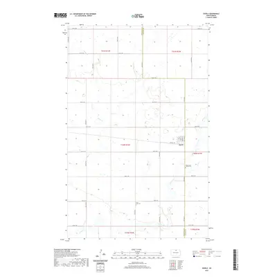
2020 Map of Overly
USGS Topo · Published 2020About this map
Overly stands as the primary settlement on this North Dakota prairie landscape, situated near the boundary between Bottineau and Rolette counties. The town plan is clearly defined by its street grid, featuring Main St, Cornell St, and Central Ave. This 2020 map records a region shaped by a dense network of sectional roads, such as 92nd St NE and 24th Ave NE, which partition the agricultural land. Significant water features wind through the townships, including Willow Cr, Miller Cr, and Mud Cr, often surrounded by small wetland pockets. For family historians, the location of the Willow Creek Lutheran Cem and Little Fargo Cem provides essential points of reference for tracing local heritage in this rural community.
Find a feature on this map
32 named features on this map. Tap any name to fly to it.
Don’t see what you’re looking for? This feature index may not catch every label — zoom into the map to look around manually.
Map Details
Editions of this 2020 Overly Map
This is the sole edition of this map. No revisions or reprints were ever made.
Other maps of this area

1935 · Dunseith
USGS Topo · 1:48,000

1939 · Dunseith
USGS Topo · 1:62,500

1954 · Overly SE
USGS Topo · 1:24,000

1954 · Omemee
USGS Topo · 1:24,000

1954 · Barton
USGS Topo · 1:24,000

1954 · Willow City
USGS Topo · 1:24,000

1954 · Minot
USGS Topo · 1:250,000

1955 · Fonda
USGS Topo · 1:24,000

1955 · Lords Lake
USGS Topo · 1:24,000

1955 · Dunseith
USGS Topo · 1:24,000