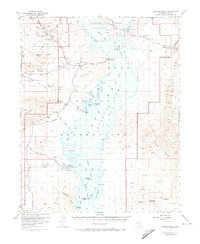
1953 Map of Overton Beach
USGS Topo · Published 1974About this map
St Thomas sits submerged beneath the waters of Lake Mead National Recreation Area, a poignant reminder of the landscape's transformation following the construction of Hoover Dam. This 1950s era survey, updated with 1970 aerial photography, captures the northern reaches of the reservoir where the Muddy River and Virgin River converge. The desert terrain surrounding the water is marked by industrial sites like the Florence Mine and the Nevada Silica Sand Mine near Silica Dome, highlighting the mineral extraction that preceded the area's recreational shift.
Find a feature on this map
57 named features on this map. Tap any name to fly to it.
Don’t see what you’re looking for? This feature index may not catch every label — zoom into the map to look around manually.
Map Details
Editions of this 1953 Overton Beach Map
4 editions found
Other maps of this area

1886 · Saint Thomas
USGS Topo · 1:250,000

1893 · Saint Thomas
USGS Topo · 1:250,000

1926 · Bonelli
USGS Topo · 1:96,000

1926 · Boulder Canyon
USGS Topo · 1:96,000

1953 · Muddy Peak
USGS Topo · 1:62,500

1953 · Overton Beach
USGS Topo · 1:62,500

1953 · Iceberg Canyon
USGS Topo · 1:62,500

1953 · Gold Butte
USGS Topo · 1:62,500

1953 · Hoover Dam
USGS Topo · 1:62,500

1953 · Virgin Basin
USGS Topo · 1:62,500