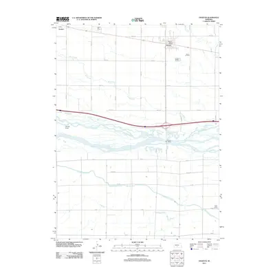
2011 Map of Overton
USGS Topo · Published 2011About this map
Overton serves as the central hub of this Nebraska landscape, where the agricultural grid meets the braided channels of the Platte River. The town is well-documented with local landmarks like the Overton Post Office and the nearby Overton Golf Course, reflecting a settled community established along the rail and road corridors of Dawson County. To the west, the smaller settlement of Josselyn sits along the same transit line, while the southern portion of the map is defined by the significant hydraulic engineering of the Phelps County Canal.
Find a feature on this map
30 named features on this map. Tap any name to fly to it.
Don’t see what you’re looking for? This feature index may not catch every label — zoom into the map to look around manually.
Map Details
Editions of this 2011 Overton Map
This is the sole edition of this map. No revisions or reprints were ever made.
Other maps of this area

1896 · Lexington
USGS Topo · 1:125,000

1896 · Kearney
USGS Topo · 1:125,000

1899 · Lexington
USGS Topo · 1:125,000

1955 · Grand Island
USGS Topo · 1:250,000

1957 · Grand Island
USGS Topo · 1:250,000

1958 · Grand Island
USGS Topo · 1:250,000

1961 · Elm Creek West
USGS Topo · 1:24,000

1961 · Miller SW
USGS Topo · 1:24,000

1962 · Lexington SE
USGS Topo · 1:24,000

1962 · Lexington East
USGS Topo · 1:24,000
Featured Places
- Overton, NE
- Northside Village Mobile Home Park, Overton
- Josselyn, NE
- Dawson County, NE
- Phelps County, NE