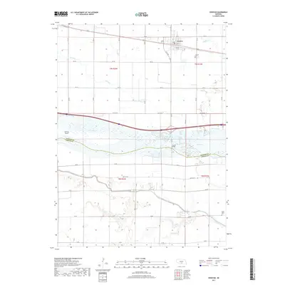
2017 Map of Overton
USGS Topo · Published 2017About this map
The village of Overton sits on the northern edge of the Platte River valley, serving as a hub for the surrounding agricultural plains of Dawson County. This 2017 survey details a landscape defined by water management and transport, where the Platte River splits around Jeffreys Island and the South Channel Platte River. To the south, the massive Phelps County Canal cuts through the terrain, illustrating the region's reliance on large-scale irrigation systems. Local history and genealogy are anchored by the Overton Cem just outside the village and the Platte Valley Cem further south. The map documents the intricate grid of rural routes, from Westside Rd to the various numbered section lines like RD 440, which facilitate the movement of goods and people across the river via the Overton Bridge.
Find a feature on this map
48 named features on this map. Tap any name to fly to it.
Don’t see what you’re looking for? This feature index may not catch every label — zoom into the map to look around manually.
Map Details
Editions of this 2017 Overton Map
This is the sole edition of this map. No revisions or reprints were ever made.
Other maps of this area

1896 · Lexington
USGS Topo · 1:125,000

1896 · Kearney
USGS Topo · 1:125,000

1899 · Lexington
USGS Topo · 1:125,000

1955 · Grand Island
USGS Topo · 1:250,000

1957 · Grand Island
USGS Topo · 1:250,000

1958 · Grand Island
USGS Topo · 1:250,000

1961 · Elm Creek West
USGS Topo · 1:24,000

1961 · Miller SW
USGS Topo · 1:24,000

1962 · Lexington SE
USGS Topo · 1:24,000

1962 · Lexington East
USGS Topo · 1:24,000
Featured Places
- Overton, NE
- Northside Village Mobile Home Park, Overton
- Josselyn, NE
- Dawson County, NE
- Phelps County, NE