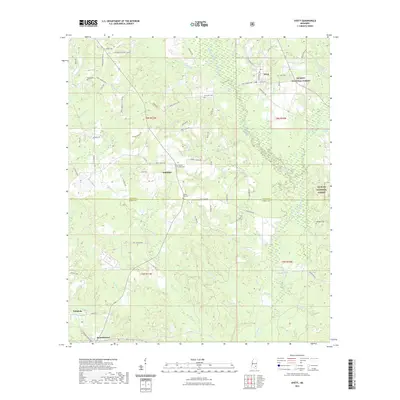
2021 Map of Ovett
USGS Topo · Published 2021About this map
Ovett and Whitfield anchor this section of south Mississippi, where the headwaters of numerous creeks drain toward the Bogue Homo. The landscape is defined by the eastern reaches of the De Soto National Forest, transitioning from upland ridges to the wet bottomlands of Big Thick Br and Mike Br. The map reveals a high density of rural burial sites, including the Beech Cem, Lancaster Cem, and Woodard Cem, which serve as vital landmarks for genealogists and local historians tracking family histories in Jones and Perry Counties. The road network, including names like Ovett-Moselle Rd and Crocker Rd, follows the terrain's natural contours, connecting the primary settlements to outlying areas like Tallahala and Runnelstown. This modern survey details the intricate drainage patterns of Sholars Mill Cr and Smith Mill Cr, reflecting the region's enduring reliance on its water resources and forested timberlands.
Find a feature on this map
82 named features on this map. Tap any name to fly to it.
Don’t see what you’re looking for? This feature index may not catch every label — zoom into the map to look around manually.
Map Details
Editions of this 2021 Ovett Map
This is the sole edition of this map. No revisions or reprints were ever made.
Other maps of this area

1953 · Hattiesburg
USGS Topo · 1:250,000

1958 · Hattiesburg
USGS Topo · 1:250,000

1963 · Barrontown
USGS Topo · 1:24,000

1964 · Carterville
USGS Topo · 1:24,000

1964 · Rhodes
USGS Topo · 1:24,000

1964 · Ovett SE
USGS Topo · 1:24,000

1964 · Ovett
USGS Topo · 1:24,000

1964 · Richton
USGS Topo · 1:24,000

1964 · Ellisville
USGS Topo · 1:24,000

1964 · Strengthford
USGS Topo · 1:24,000