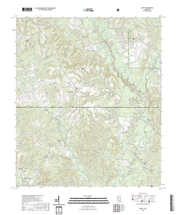
2024 Map of Ovett
USGS Topo · Published 2024About this map
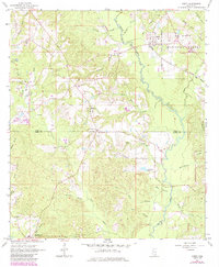
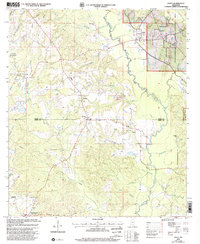
Ovett serves as a primary hub in this corner of the Pine Belt, situated where the De Soto National Forest meets a network of timberlands and rural homesteads. The landscape is defined by the winding course of the Bogue Homo and its many tributaries, including Shallow Hill Creek and Redbank Branch. This modern survey illustrates the persistent rural character of Jones and Perry counties, where small communities like Whitfield and Runnelstown are connected by a web of local roads such as Ovett-Moselle Rd and Ovett Petal Rd.
Find a feature on this map
88 named features on this map. Tap any name to fly to it.
Don’t see what you’re looking for? This feature index may not catch every label — zoom into the map to look around manually.
Map Details
Editions of this 2024 Ovett Map
This is the sole edition of this map. No revisions or reprints were ever made.