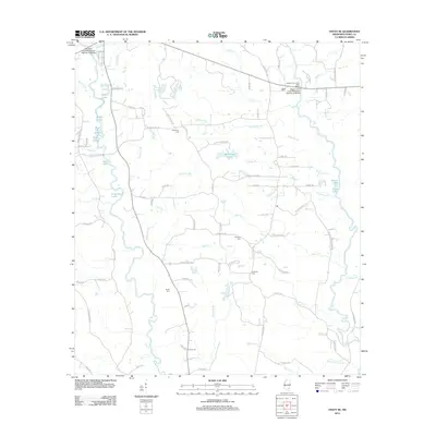
2012 Map of Ovett SE
USGS Topo · Published 2012About this map
Tallahala Cr and the Bogue Homo drainage systems define the landscape of Perry County in this 2012 survey. The area is characterized by a dense network of creeks and small lakes, including Gandy Lake, Eddy Lake, and the larger Sportsman Lake. These waterways are connected by a web of local roads such as Buck Creek Rd and Dixon Rd, reflecting a rural pattern of development focused on timber and water access. Genealogists will find several notable family and community burial grounds, including McGilvary Cem, Prospect Cem, Courtney Cem, and James Cem. The map also highlights local infrastructure like the Bogue Homo Creek Boat Ramp and the Tallahalla Creek Mississippi Highway 42 Bridge, providing insight into contemporary recreational and transport patterns in this corner of Mississippi.
Find a feature on this map
101 named features on this map. Tap any name to fly to it.
Don’t see what you’re looking for? This feature index may not catch every label — zoom into the map to look around manually.
Map Details
Editions of this 2012 Ovett SE Map
This is the sole edition of this map. No revisions or reprints were ever made.
Other maps of this area

1947 · Beaumont
USGS Topo · 1:62,500

1947 · New Augusta
USGS Topo · 1:62,500

1949 · Beaumont
USGS Topo · 1:62,500

1949 · New Augusta
USGS Topo · 1:62,500

1953 · Hattiesburg
USGS Topo · 1:250,000

1958 · Hattiesburg
USGS Topo · 1:250,000

1963 · Barrontown
USGS Topo · 1:24,000

1964 · Carterville
USGS Topo · 1:24,000

1964 · Rhodes
USGS Topo · 1:24,000

1964 · Ovett SE
USGS Topo · 1:24,000