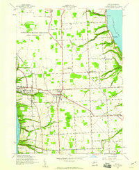
1942 Map of Ovid
USGS Topo · Published 1960About this map
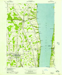
The United States Military Reservation Seneca Ordnance Depot dominates the northern landscape of this Finger Lakes survey, established during the height of the Second World War. Centered between the deep waters of Seneca Lake and Cayuga Lake, the region shows a transition from military infrastructure to a traditional rural economy. The town of Ovid serves as a central hub, surrounded by smaller crossroads and hamlets such as Hayts Corners and Tannery Corners.
Find a feature on this map
36 named features on this map. Tap any name to fly to it.
Don’t see what you’re looking for? This feature index may not catch every label — zoom into the map to look around manually.
Map Details
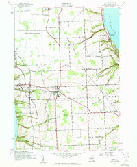
Editions of this 1942 Ovid Map
3 editions found
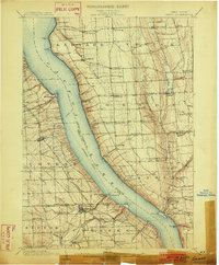
Other maps of this area

1899 · Auburn
USGS Topo · 1:62,500

1902 · Geneva
USGS Topo · 1:62,500
1902 · Genoa
USGS Topo · 1:62,500

1902 · Ovid
USGS Topo · 1:62,500

1902 · Auburn
USGS Topo · 1:62,500
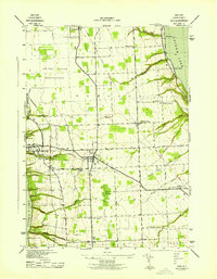
1942 · Ovid
USGS Topo · 1:31,680
1942 · Dundee
USGS Topo · 1:24,000

1942 · Lodi
USGS Topo · 1:24,000

1942 · Sheldrake
USGS Topo · 1:24,000
1942 · Trumansburg
USGS Topo · 1:24,000