
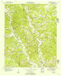
1936 Map of Ovilla
USGS Topo · Published 1936About this map
The Wayne and Lawrence County line bisects this 1936 survey, showing a rural landscape organized around the Little Buffalo River and a network of named creek branches. Small rural settlements like Ovilla, Bird, and Gower are interconnected by U S Highway No 64, reflecting the era's transition toward improved automotive travel. Social life in these communities is anchored by local institutions such as County Line Church and several community schoolhouses, including Highland School and Piney School.
Find a feature on this map
50 named features on this map. Tap any name to fly to it.
Don’t see what you’re looking for? This feature index may not catch every label — zoom into the map to look around manually.
Map Details
Editions of this 1936 Ovilla Map
This is the sole edition of this map. No revisions or reprints were ever made.
Other maps of this area

1905 · Waynesboro
USGS Topo · 1:125,000

1936 · Riverside
USGS Topo · 1:24,000

1936 · Westpoint
USGS Topo · 1:24,000

1936 · Deerfield
USGS Topo · 1:24,000

1936 · Collinwood
USGS Topo · 1:24,000

1936 · Henryville
USGS Topo · 1:24,000

1936 · Negro Hollow
USGS Topo · 1:24,000

1936 · Long Branch
USGS Topo · 1:24,000

1936 · Topsy
USGS Topo · 1:24,000
1950 · Westpoint
USGS Topo · 1:24,000