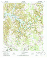
1972 Map of Ovoca
USGS Topo · Published 1977About this map
Tullahoma serves as the primary hub in this early 1970s Coffee County survey, which documents a landscape on the verge of significant hydrologic change. The Duck River winds through the center of the sheet, where the proposed Normandy Dam and its future lake level are clearly delineated. This transition from a riverine valley to a reservoir-dominated landscape is captured alongside long-standing rural landmarks like Ward Chapel, Blanton Chapel, and several family cemeteries including Hodge Cem and Old Redden Cem. To the southeast, the expansive footprint of the Arnold Engineering Development Center indicates the presence of federal aerospace research facilities. Transportation is anchored by the historic Nashville and Chattanooga Railroad and the Old Hillsboro Road, connecting the outlying residential areas of Lake Hills and Homeway Village to the municipal core.
Find a feature on this map
87 named features on this map. Tap any name to fly to it.
Don’t see what you’re looking for? This feature index may not catch every label — zoom into the map to look around manually.
Map Details
Editions of this 1972 Ovoca Map
2 editions found
Other maps of this area

1913 · Hollow Springs
USGS Topo · 1:62,500

1936 · Ovoca
USGS Topo · 1:24,000

1936 · Fredonia
USGS Topo · 1:24,000

1936 · Manchester
USGS Topo · 1:24,000

1936 · Cumberland Springs
USGS Topo · 1:24,000

1936 · Noah
USGS Topo · 1:24,000

1936 · Wartrace
USGS Topo · 1:24,000

1936 · Camp Peay
USGS Topo · 1:24,000

1936 · Capitol Hill
USGS Topo · 1:24,000

1936 · Normandy
USGS Topo · 1:24,000