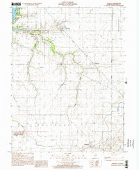
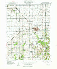
1998 Map of Owaneco
USGS Topo · Published 2002About this map
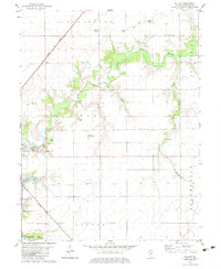
Owaneco serves as a central hub in this late-twentieth-century landscape, defined by a grid of agricultural townships and the diagonal path of the Baltimore and Ohio railroad. The terrain is marked by the winding courses of Locust Creek and Cottonwood Creek, which break the geometric precision of the surrounding farmland. This transition from natural drainage to engineered water management is evident in the Main Drainage Ditch to the east. Local history and genealogy researchers can find significant sites like Durbin Cem, Buckeye Cem, and the uniquely named Potters Field Cem. Small rural settlements such as Millersville and Rosamond anchor the corners of the quadrangle, while the Metsker Landing Strip provides a specific look at local aviation infrastructure in this corner of Christian County. The map also traces the Third Principal Meridian, a critical line for land surveying and property records in Illinois.
Find a feature on this map
17 named features on this map. Tap any name to fly to it.
Don’t see what you’re looking for? This feature index may not catch every label — zoom into the map to look around manually.
Map Details
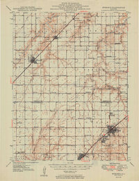
Editions of this 1998 Owaneco Map
This is the sole edition of this map. No revisions or reprints were ever made.
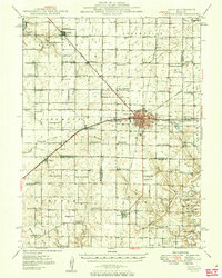
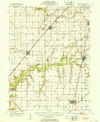
Other maps of this area
1923 · Taylorville
USGS Topo · 1:62,500
1925 · Taylorville
USGS Topo · 1:62,500
1946 · Nokomis
USGS Topo · 1:62,500
1947 · Pana
USGS Topo · 1:62,500
1949 · Nokomis
USGS Topo · 1:62,500
1949 · Pana
USGS Topo · 1:62,500
1952 · Assumption
USGS Topo · 1:62,500

1958 · Decatur
USGS Topo · 1:250,000

1961 · Decatur
USGS Topo · 1:250,000
1974 · Willeys
USGS Topo · 1:24,000