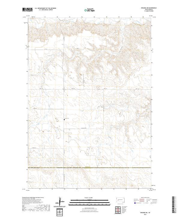
2021 Map of Owanka NE
USGS Topo · Published 2021About this map
The prairie landscape of Meade and Pennington counties is defined by the ephemeral flow of Elk Cr and the deeply etched contours of Hay Draw. This 2021 survey of the rural landscape north of Owanka reveals a sparse network of section roads and grazing lands, anchored by the Lakeside Cem near the intersection of Co Hwy Mc-29 and Vanderheld Rd. The map illustrates the geometric precision of the Public Land Survey System, with township boundaries like t3n r12e and t3n r13e carving the terrain into a predictable grid.
Find a feature on this map
16 named features on this map. Tap any name to fly to it.
Don’t see what you’re looking for? This feature index may not catch every label — zoom into the map to look around manually.
Map Details
Editions of this 2021 Owanka NE Map
This is the sole edition of this map. No revisions or reprints were ever made.
Other maps of this area

1953 · Rapid City
USGS Topo · 1:250,000

1954 · Elm Springs SW
USGS Topo · 1:24,000

1954 · Dalzell
USGS Topo · 1:24,000

1954 · Wasta
USGS Topo · 1:24,000

1954 · Owanka
USGS Topo · 1:24,000

1954 · Wasta NW
USGS Topo · 1:24,000

1954 · Elm Springs
USGS Topo · 1:24,000

1957 · Rapid City
USGS Topo · 1:250,000
1957 · Owanka NE
USGS Topo · 1:24,000
1957 · Owanka NW
USGS Topo · 1:24,000