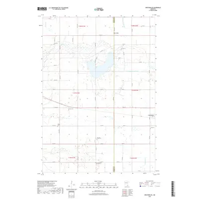
2019 Map of Owatonna SE
USGS Topo · Published 2019About this map
Rice Lake sits at the center of this agricultural landscape along the border of Steele and Dodge Counties. This portion of southern Minnesota is defined by the headwaters of the Zumbro River system, including the Middle Fork Zumbro River and the S Br Middle Fork Zumbro River. The settlement of Claremont is established in the eastern portion of the map, served by a network of rural roads such as 620th St and Co Hwy 19. For genealogists and local historians, the sheet is particularly dense with community landmarks, including the Aurora Lutheran Cem, Saint John's Lutheran Cem, and the German Methodist Episcopal Cem. These sites, along with smaller family or church plots like Thompson Cem and Hillside Cem, provide a precise record of the regional settlement pattern and the cultural heritage of the township inhabitants.
Find a feature on this map
44 named features on this map. Tap any name to fly to it.
Don’t see what you’re looking for? This feature index may not catch every label — zoom into the map to look around manually.
Map Details
Editions of this 2019 Owatonna SE Map
This is the sole edition of this map. No revisions or reprints were ever made.
Other maps of this area

1953 · Saint Paul
USGS Topo · 1:250,000

1954 · Mason City
USGS Topo · 1:250,000

1957 · Mason City
USGS Topo · 1:250,000

1958 · Mason City
USGS Topo · 1:250,000

1959 · Saint Paul
USGS Topo · 1:250,000

1962 · Medford East
USGS Topo · 1:24,000

1962 · Owatonna
USGS Topo · 1:24,000

1962 · Moland
USGS Topo · 1:24,000

1962 · Owatonna SE
USGS Topo · 1:24,000

1965 · Claremont
USGS Topo · 1:24,000